

Superstorm Sandy: October 2012
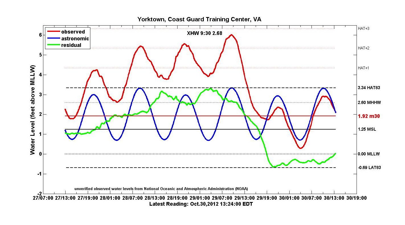
 Yorktown Coast Guard Training Center The 3-day Tidewatch record for the Yorktown Coast Guard Training Center during the passage of "Superstorm Sandy."
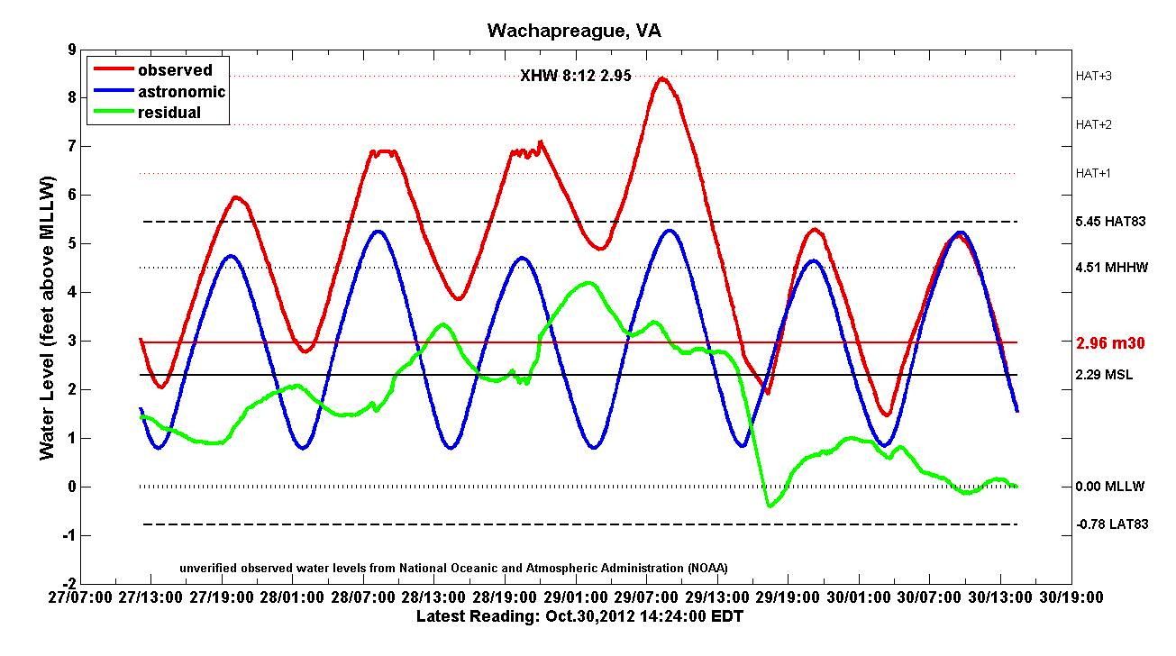
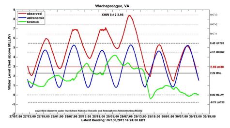 Wachapreague The 3-day Tidewatch record for Wachapreague, Virginia during the passage of "Superstorm Sandy."
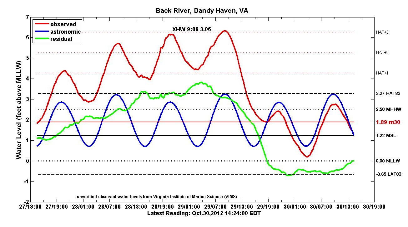
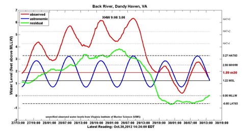 Back River/Dandy Haven Marina The 3-day Tidewatch record for Back River/Dandy Haven Marina during the passage of "Superstorm Sandy."
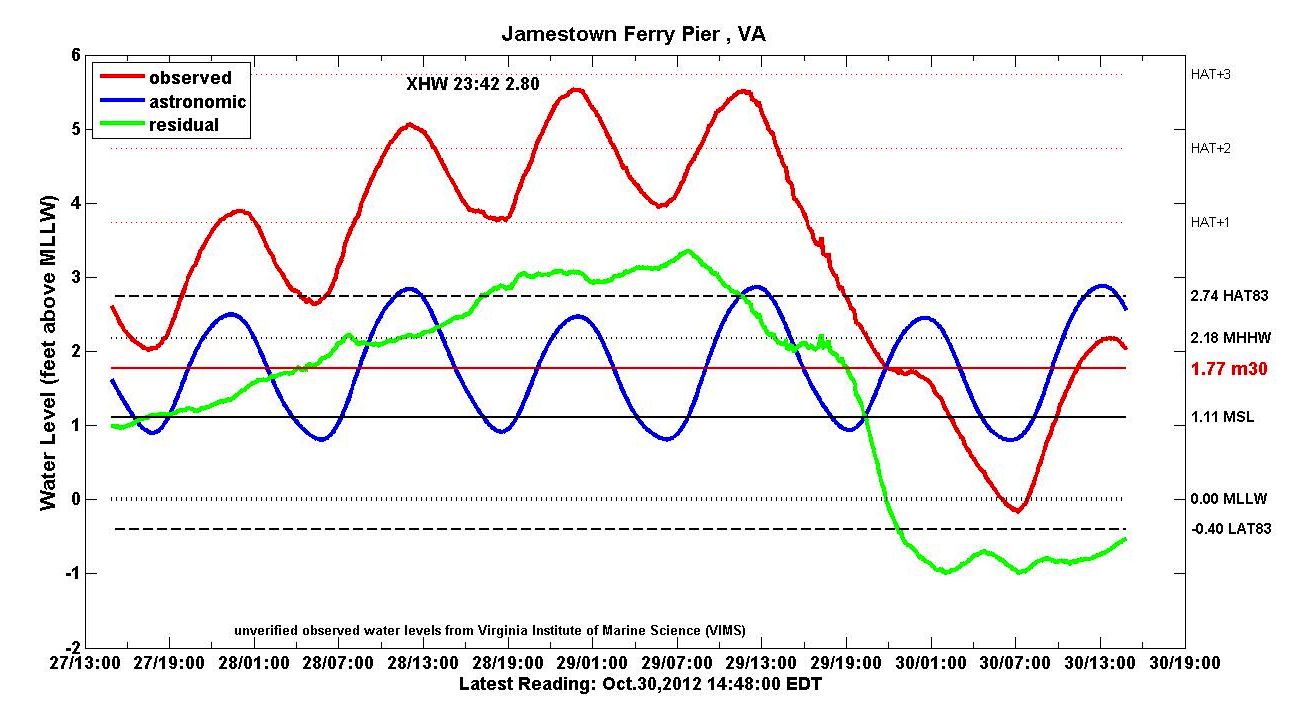
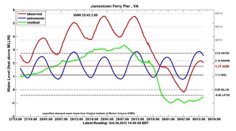 Jamestown Ferry Pier The 3-day Tidewatch record for the Jamestown Ferry Pier during the passage of "Superstorm Sandy."
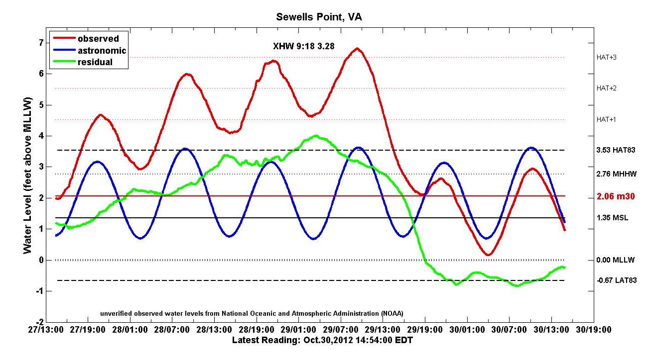
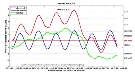 Sewells Point The 3-day Tidewatch record for Sewells Point during the passage of "Superstorm Sandy."
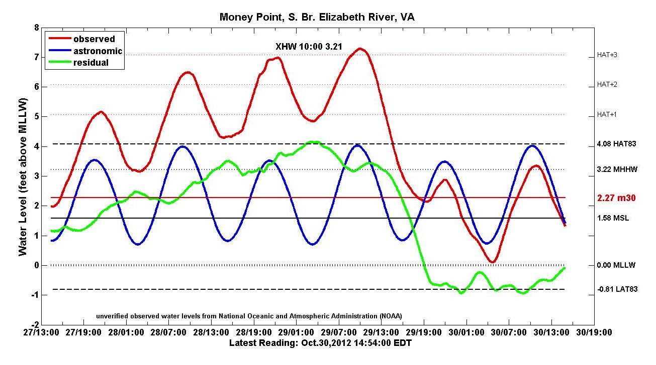
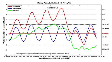 Money Point The 3-day Tidewatch record for Money Point during the passage of "Superstorm Sandy."
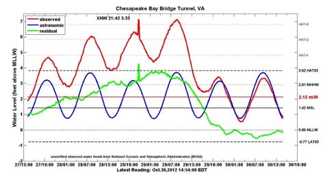 Chesapeake Bay Bridge Tunnel The 3-day Tidewatch record for the Chesapeake Bay Bridge Tunnel during the passage of "Superstorm Sandy."
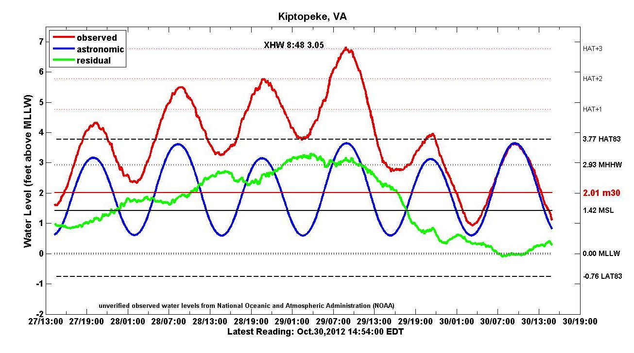
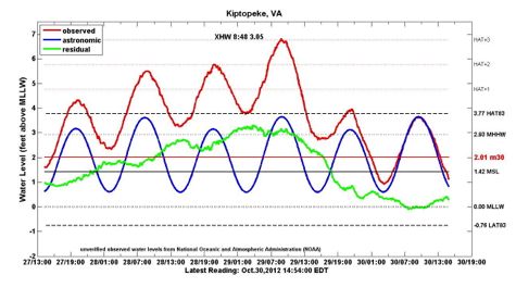 Kiptopeke The 3-day Tidewatch record for Kiptopeke during the passage of "Superstorm Sandy."
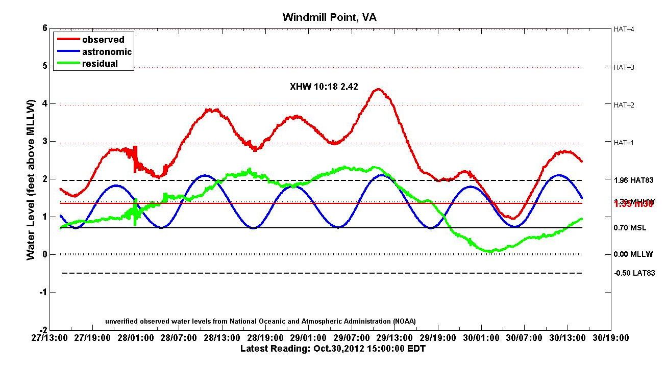
 Windmill Point The 3-day Tidewatch record for Windmill Point during the passage of "Superstorm Sandy."
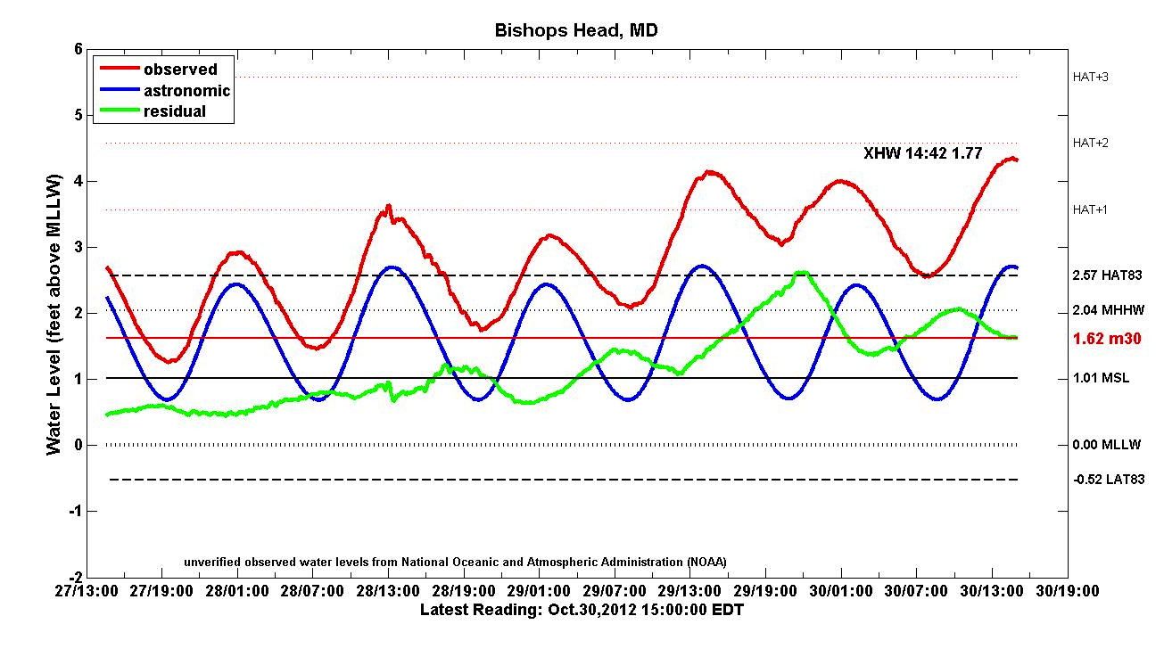
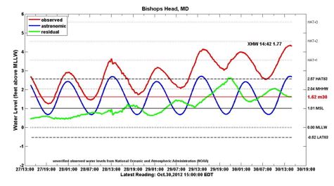 Bishops Head, MD The 3-day Tidewatch record for Bishops Head, Maryland during the passage of "Superstorm Sandy."
Data from the Tidewatch network show that peak water levels in lower Chesapeake Bay during "Superstorm Sandy" were about a half a foot lower than experienced during the passage of Hurricane Irene (August 2011), Hurricane Isabel (September 2003), or “Nor’Ida” (November 2009). The most notable aspect of the storm was its duration, with elevated water levels persisting through 4 successive high-tide cycles, from the evening high tide on Saturday, October 27th through the morning high tide on Monday, October 29th.
Available Tidewatch Charts
Back River, Dandy Haven Marina (BRDH): 3-day record
Bishops Head, MD (BISH): 3-day record
Chesapeake Bay Bridge Tunnel (CBBT): 3-day record
Jamestown Ferry Pier (JMTN): 3-day record
Kiptopeke (KIPT): 3-day record
Money Point (MNPT): 3-day record
Sewell's Point (SWPT): 3-day record
Wachapreague (WACH): 3-day record
Windmill Point (WMPT): 3-day record
Yorktown Coast Guard Training Center (YRCG): 3-day record