
As hurricane season rolls in, VIMS rolls out prediction tools
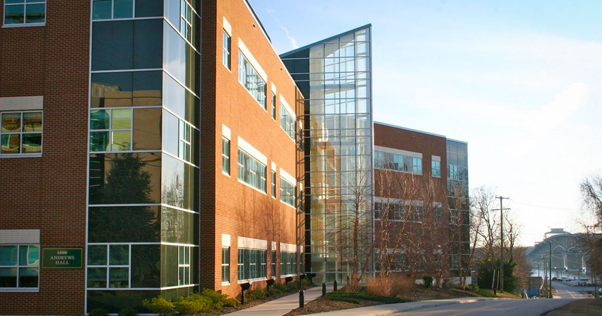
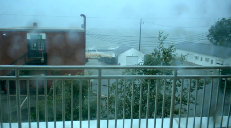 Hurricane Irene Waves hit the VIMS shoreline during Hurricane Irene. Photo from Andrews Hall at ~ 2 pm on Saturday August 27th 2011 by David Forrest.
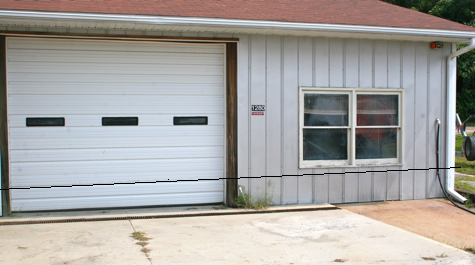 Boat Shed Superimposed black line indicates the extent of flooding in the VIMS Boat Basin during Hurricane Irene in August 2011.
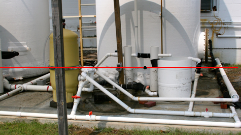 Floodline Superimposed red line marks the extent of high water in VIMS Boat Basin during Hurricane Irene in August 2011.
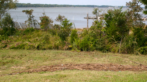 Wrackline Wrackline above VIMS Beach shows extent of high water during Hurricane Irene in August 2011.
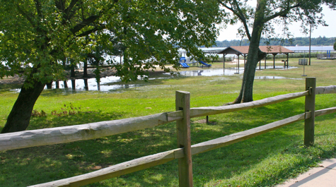 Gloucester Point Park Residual water in Gloucester Point Park following Hurricane Irene on August 27 2011.
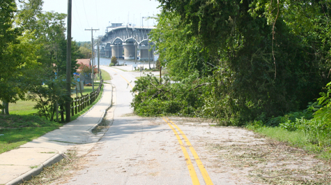 Downed Tree A tree obstructs Greate Road near the bottom of hill at Gloucester Point following Hurricane Irene in August 2011.
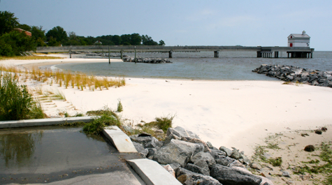 Pier and Breakwaters New elevated concrete pier and stone breakwaters minimized damage to the VIMS shoreline during Hurricane Irene in August 2011.
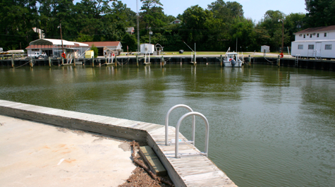 An empty Boat Basin A rare sight as nearly all of the vessels have been removed from the VIMS Boat Basin in preparation for Hurricane Irene in August 2011.
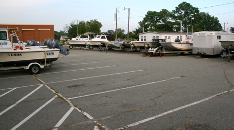 Vessels in Triangle Parking Lot VIMS staff moved nearly all of VIMS' 40-vessel fleet from the Boat Basin onto higher ground in preparation for Hurricane Irene in August 2011.
The official start of the 2012 Atlantic hurricane season on June 1—along with the early appearance of Alberto and Beryl and fresh memories of last year's Hurricane Irene—hopefully has Virginians stocking up on storm essentials such as first-aid supplies, water, and generators.
Now there's another item that should be in every coastal resident's hurricane toolkit: an online water-level-monitoring tool called TideWatch (http://www.vims.edu/tidewatch).
Tidewatch, and its companion product the Real-Time Storm Tide Observation and Forecast System (Rstofs), were developed by researchers at the Virginia Institute of Marine Science. Both proved useful during Irene. One Deltaville business used TideWatch to manage its operations during the storm, while the National Weather Service used Rstofs to predict coastal flooding, leading to the evacuation of some areas of Hampton Roads.
VIMS professor emeritus John Boon led the development of TideWatch and Rstofs, and with the help of Virginia Sea Grant, he and colleagues John Brubaker and David Forrest have now been training emergency managers and coastal businesses to use the tools.
For Boon, the value of these systems lies not just in coordinating evacuations but in protecting personal property. “Even if there’s no call to evacuate, emergency managers can look at our system and say, ‘Move your car’,” says Boon.
Protecting Property
Hurricanes and nor’easters can cause major damage to property, and this is certainly true for coastal businesses like marinas. Lew Grimm, owner of Deltaville Yachting Center, recalls the $250,000 damage his marina experienced during a previous storm.
“When Hurricane Isabel came in 2003, we didn’t have any information about how water levels would change,” says Grimm. Knowing when dramatic shifts in water levels will occur is important in the marina world. When a boat is tied down, it can pull apart docks as it rises or falls with the water. To prevent this, employees loosen ropes when water gets extremely low or high and tighten ropes when the water levels are near normal.
“We had our people scheduled two shifts a-day, not scheduled by the natural cycles associated with the storm,” says Grimm. “We exhausted our resources needlessly.”
Without information on water levels, he says, “We didn’t anticipate the water-level change, and the boats were tied without sufficient slack [in the rope] to rise.”
Grimm learned about TideWatch when Virginia Sea Grant sponsored a workshop by the VIMS research team in Deltaville in 2009. Since then, Grimm says, he checks the system weekly and his marina has accrued no damage, despite a 2009 nor’easter and Hurricane Irene in 2011—storms that together totaled almost $50M in damages for the state.
“[TideWatch] also allowed us to give our customers some comfort,” Grimm says. “When you get in the middle of a storm like Irene, you get this feeling that this will go on forever.” But by updating his customers via email two or three times a day, he was able to keep customers calm.
“They absolutely loved the fact that we had real information to give them,” he says. “Knowing their boats are well-tended, they could focus on downed trees or other problems at their homes.”
Advising Evacuation
When it comes to weather-related emergencies, Bill Sammler would agree that knowledge is power. Sammler, external liaison with the National Weather Service's forecast office in Wakefield, works directly with emergency managers throughout Virginia. During storms, he monitors several different computer models and uses that information to advise localities on evacuation. When Irene came, Sammler had a new tool: the Real-time Storm Tide Observation and Forecast System (Rstofs).
Rstofs is an experimental system, Boon cautions. By the time he and the VIMS research team rolled the system out to emergency managers throughout coastal Virginia in 2011, it had proven accurate for the 2009 nor’easter, but it hadn’t been tested during a hurricane.
“Irene was the real test of Rstofs,” Sammler says. “And it turned out to be very accurate.”
For more than 30 years, the Weather Service has predicted coastal flooding using a model called SLOSH (Sea Lake Overland Surge for Hurricanes). The model was designed for what Sammler refers to as “true tropical storms” typically low-latitude affairs in which the air and water are warm. But when Virginia sees a hurricane, it’s typically a weakened storm or one that has interacted with a mid-latitude weather front and transitioned into an "extratropical cyclone."
“This part of the Atlantic coast is an area where you’re often dealing with a storm that has already made landfall. Those systems undergo a transition, and they change their characteristics as they make landfall and as they get over colder water,” says Sammler. For this reason, the SLOSH model is less accurate in forecasting flooding for storms in Virginia.
When Rstofs forecasted flooding in lower Hampton Roads during Irene, Sammler conveyed this information to local emergency managers. In the end, managers decided to evacuate some of the most vulnerable areas.
The accuracy of the Rstofs system is promising for Sammler, who knows that accurate information builds the confidence of residents and emergency managers during a storm.
“Whether it means moving some of their belongings or whether it means evacuation, the more accurate information you can give people, the better chance you can convince them to take the actions to protect themselves and their property,” he says.